


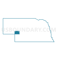
Lonergan Precinct, Keith County, Nebraska
About
Outline

Summary
| Unique Area Identifier | 613323 |
| Name | Lonergan Precinct |
| County | Keith County |
| State | Nebraska |
| Area (square miles) | 159.37 |
| Land Area (square miles) | 131.09 |
| Water Area (square miles) | 28.28 |
| % of Land Area | 82.26 |
| % of Water Area | 17.74 |
| Latitude of the Internal Point | 41.30360870 |
| Longtitude of the Internal Point | -101.85873000 |
Maps


Graphs
Select a template below for downloading or customizing gragh for Lonergan Precinct, Keith County, Nebraska


Neighbors
Neighoring Voting District (by Name) Neighboring Voting District on the Map
- Arthur Precinct, Arthur County, NE
- Blue Creek Precinct, Garden County, NE
- Brule Precinct, Keith County, NE
- Ogallala Rural One Precinct, Keith County, NE
- Whitetail Precinct, Keith County, NE
Top 10 Neighboring County Subdivision (by Population) Neighboring County Subdivision on the Map
- Brule precinct, Keith County, NE (811)
- Rural Ogallala precinct, Keith County, NE (808)
- Blue Creek precinct, Garden County, NE (553)
- Lonergan precinct, Keith County, NE (471)
- Arthur precinct, Arthur County, NE (460)
- Whitetail precinct, Keith County, NE (299)
Top 10 Neighboring Place (by Population) Neighboring Place on the Map
Top 10 Neighboring Unified School District (by Population) Neighboring Unified School District on the Map
- Ogallala Public Schools, NE (6,735)
- Garden County Schools, NE (2,097)
- Arthur County Schools, NE (484)
- School District Not Defined, NE (0)
Top 10 Neighboring State Legislative District Upper Chamber (by Population) Neighboring State Legislative District Upper Chamber on the Map
Top 10 Neighboring 111th Congressional District (by Population) Neighboring 111th Congressional District on the Map
Top 10 Neighboring Census Tract (by Population) Neighboring Census Tract on the Map
- Census Tract 3, Keith County, NE (3,575)
- Census Tract 9521, Garden County, NE (2,057)
- Census Tract 9583, Arthur County, NE (460)